Taipoutini polytechnic first tramp
Cassey
saddle – Binser saddle route.
Group Justin,
Makayla, Mathew, Gatland, Rachel, Ryan and Myself
Instructor Asher March
Duration Three
days
Date 16/2/16 - 19/2/16
Weather Overcast/light rain
Learnings Navigation, grid references, hand railing, taking bearings, identifying land features
Day 1
Date 16/2/16 - 19/2/16
Weather Overcast/light rain
Learnings Navigation, grid references, hand railing, taking bearings, identifying land features
Day 1

Asher then set us our first challenge. On the map we are to
give three bits of evidence that proves where we are on the map. We also talk
about what we hope to get out of the trip and what we hope to learn. After this
we start our expedition. The track initially climbs from around 580 meters to
788 meters. Along the way Asher teaches us a little about the flora we pass and
we just have general chats to get to know one and other. As we get closer to
reaching the high point, Asher introduces the idea of finding where we are by looking for proof. He explains how we can recognise where we are by what we have seen earlier, what we’re currently seeing and what we expect to see. From this we can translate that onto the map. At first this seems like an impossible task, but as Asher points out features and what they look like on a map it slowly
becomes clearer. From here the track flattens out and we make our way
crossing over two small streams. These provide a good place to stop and a
chance to top up our water. Asher discusses how not all streams are mapped. Just because there are a couple of
streams mapped it doesn’t mean there won’t be more streams that aren't on the map. This reinforces his point that you don’t just want one bit
of information to prove where you are, you want multiple pieces of evidence to create a bigger picture.

Day 2
The alarm goes off, and it’s time to hustle. I pack my bag, take my
tent down and move onto cooking breakfast. Porridge is on the menu today and I‘m
ready for it. We have a lot of ground to
make up today and with that in mind I'm thinking the earlier we get away the better. After
breakfast we group up and Asher gives us a short navigation test. We are to work
out the grid references, our speed of travel and the distances to Casey hut and Mount Brown creek. This brings a totally different dimension to being in the
bush. So with the morning navigation test done and dusted we start
making our way to Casey hut. We initially start climbing to around 890 meters
before the track flattens out for just over a kilometre. From here we start climbing a steep spur that
twists its way north east. Asher takes the time to point out any flora along the
way and the team just keeps laps it up. It’s not long and before you know it
we’re at Casey hut. Here we take a short break, rehydrate and on we march.
From Casey hut the track flattens
and meanders for some time before opening up at a large clearing. We then travelled
through the grasslands and tussock towards a lake on the map. There we meet another
group coming from the opposite way. We have a good yarn to them and make a plan
for lunch. Asher set Ryan a challenge to navigate to a particular spot he does
this and there we stop for lunch.
 lands onto Rabbit flats Asher sets individual navigational challenges. I’m up and it seems I’ve made a huge
blunder. I’ve ended up off the track at Poulter River on the east. I’ve
realised what I’ve done and I’m off to correct it. Now back on track I can see
the valley leading down to where Asher has told me to navigate to. I find the
stream and start moving up it. I miss the fork I was spouse to navigate to but
it’s all good learning and when Asher point out a few defining details of how he
knows we missed it I start to see it.
lands onto Rabbit flats Asher sets individual navigational challenges. I’m up and it seems I’ve made a huge
blunder. I’ve ended up off the track at Poulter River on the east. I’ve
realised what I’ve done and I’m off to correct it. Now back on track I can see
the valley leading down to where Asher has told me to navigate to. I find the
stream and start moving up it. I miss the fork I was spouse to navigate to but
it’s all good learning and when Asher point out a few defining details of how he
knows we missed it I start to see it.
After the individual challenges we group up and make time
estimates of when we think we will get to the turn off point onto Binser's
saddle track. I find having a goal and a time in mind motivating. Justin is
struggling from chaffing but we’re still making really good time. We get there
well before my estimated time and before dinner we are set a new challenge. We
are to set up a shelter, get a fire going and assist Asher who is pretending to
have an injured leg. We all pitch in, set up the shelter and get the fire going
all with in good time. We have vegetarian pasta on the menu tonight and I decide to
take on the cooking duty. So with the MSR firing away and the water boiling I
begin to cook my master piece. First I cook the pasta followed by the broccoli,
eggplant, carrot and the rest of the vegetables. It comes out delicious a job
well done if I don’t say so myself. After some deep and

Day 3
Day three sees us rise early well before the other TPP
group. I know we need to get the porridge started if we are to make our goal of
being ready in an hour. Rachel mentioned to me the day before that she wanted
to light the MSR because she hadn’t done so yet. I set it up and when she’s not
ready to light it I start getting frustrated. We get there in the end but we’re
about 15 minutes of our target time. The first part of the track re-enters the forest and starts
at an easy gradient and gradually gets steeper. We plan to make our way to a
stream and go off track to a high point of 830 meters. But once we get to the
stream we establish that we have missed our turn off point and that we are at a
second stream further along the track. This is a good place of a drink of water
and a group get together. We learn how to take a bearing and start our climb
from here.

Justin is leading the charge with his bearing and I follow in behind checking that the bearing I’ve taken lines up with his. So far so good but early on I am stung by a wasp. We meet with the first stream that we wanted to leave from and move on from here. We eventually get to a point that we think could be the high point then after looking around us we establish that we have pushed too far south east and missed our target. We group together and make a new plan. Our plan is to use a technique called hand railing and to follow a stream to where it splits off and take a new bearing from there. As we come down the stream we find it quite hard to manoeuvre around because of the steepness of the bank. We get there in the end and find the high point. Now all that’s left is to do is to bush bash our way down a couple of spurs. We start crashing our way through the bush and along the way people are being stung by wasp left right and centre. There are wasp nest everywhere and not to mention a large amount of tree fall. This is dramatically slowing our speed down and at this rate we are going to be late back to the vans. We eventually get down the first spur but not without battle scars. Poor old Makayla has being stung 12 times. We stop to put on rain jackets and over trousers and finishes up the last battle down the last spur to the vans. Everyone is stoked to be back at the vans.
Taipoutini polytechnic Waitaha Day
Group Dion, Jamie, Bryce, Julies, Rachel
Instructor Rata Lovell
Duration Day trip
Date 1/4/16
Weather Overcast / Sun breaking through
Learnings Navigation, identifying land features

Today we have the incredible privilege of going to the remote Morgans gorge in the West Coast of the South Island. Morgan gorge is found about 25 to 30 kilometers past the small township of Ross. We approach the day as an adventure run with high intensity. The track follows the pristine tuques blue Waitaha river hoping over boulders along the river bank.The track eventually sidles around a spur over to Morgans gorge. Along the way we take on navigation challenges and take in as much of the surreal environment as we can. We stop for lunch in the gorge and talk about how the gorges is under threat by a purposed hydro dam scheme. This is a real shame and if put in it would drastically change the peace and tranquility of this beautiful place. Zac Shaw is supposedly with the fast group so when we catch up to them I fire him up and get a bit of smack talk happening. Zac takes it in the chin and lays down the challenge. His groups all of a sudden ups the anti and starts smashing it back. I hang back with my team for a short while but when I realize we're falling further and further behind I make the decision to ditch my group and put everything into catching up and over taking Zac's crew. I fire it up sprinting and jumping over boulders as fast as I can to make up the distance. About five minutes in I can see Zac's group in the distance. Its not long and i'm starting to power it past members of his group.I'm almost up to Zac but he seems to be picking up the pace. I've exhausted all my energy catching up to him so I can only hold the intensity to stay with him. Eventually he tires and stops for a break. I hadn't quite over taken him but catching Zac's group was a huge feet in itself. I finish the run with Zac's group, leaving my group behind. My group aren't to happy that I left them and they let me know when they finally arrive at the finish. But some times in life there's a time to break the rules, challenging yourself and putting yourself under the pump and today was one of those times.
Taipoutini polytechnic second tramp
Weather Cold snap, Snow and heavy rain
Learnings
Navigation, hand railing, taking bearings, identifying land features
Day 1
We start the day in Greymouth and leave first thing in the morning heading towards the Nelson lakes.We pass through Reefton and then onto Murchison where we stop for a bite to eat. Its a fine day but looking ahead we have a challenging deteriorating weather forecast. We plan a route while traveling in the van and get primed and ready for a big four days ahead. Once we arrive we meet Kieran McKay who is going to be our instructor. We relay our plan to him and hes stoked with it. We follow the Mole track which gradually gets steeper and meets up with the Mole stream. Its here that we come out of the spaciously carved beach track and out onto the uneven bolder hopping Mole river surface. We following the Mole stream identifying
 tributaries that feed into it on the map and bends and forks in the valleys. The track see us carry out multiply river crossing and eventually we all end up with wet boots. As the group tires we stop for breaks and refuel as much as we can. Its getting later in the day and when we get to our intended campsite being Mole hut we can see a school group have already occupied the spot. We walk onto find another campsite and spot what seems to be flat land in between the Jameson ridge track and the Mole track. We storm up to it but the land were heading to seems to be water logged and swampy. Everyone's getting tired and when we find a flat spot to camp we all make a bad decision and settle for it. Kieran takes the opportunity to teach us to always split up for 5 to 10 minutes to find a good camping spot. We do this and find a much better camp site. The plan now is to set up a base camp so we can return with everything set up as it is tomorrow. We set up tents, a fly and get dinner underway. I'm sitting by a pot of boiling water in my socks and unfortunately Kieran knocks the pot over onto it. The water burns me but I try not to make to much of a deal of it so Kieran doesn't feel bad about it. I only pour water on my foot briefly but in hind sight I should have gone down to the river and placed my foot in it for 20 minutes. I'm okay and tea with a hot drink is enough to keep my mind off the burn.
Day 2
I wake to the horrible sound of my alarm. The weather has turned and the outside temperature is freezing. It snowed last night and I can see a bunch of snow sitting on the tussocks surrounding our tent site. The worst part of the morning would have to be putting on wet boots and eating breakfast with no feeling in my feet. My hands are just as bad but I see this as a challenge to push myself and to keep preforming. Once everyone is ready we set off. We divided ourselves up so that we can undertake different navigational legs through out the day. Our Plan is to head up onto the tops, take a bearing and walk over to some tarns then head down a spur back to camp. Tom and Bryce lead the first leg leading us from our camp site and up onto a spur. The weather is unreal the wind and snow is coming at us sideways. Nathan and Gabby lead the next navigational leg up an exposed spur and onto the tops. Its an awesome experience and such a crazy environment to be out in. Its a lot of hard work but also very rewarding. We make good progress getting to the tops in good time. Conditions are
 really challenging we are out in a complete white out and snow and wind is coming at us sideways. Jake and Dion Lead the next leg taking a bearing from a high point and out to our designated tarns. Its there we stop for lunch and enjoy our salad and salami pita breads. After lunch its my turn to lead the charge and navigate us back to camp. We head up onto the ridge at 1576 meters then start descending down a spur using a couple of valleys as a handrail. I taking a bearing before heading down the spur so we I don't lead us off it. We start heading down the spur until the spur becomes to steep to climb down. We decide that the best way down is to head down a face the sidle around back onto it. Once back on the spur its not to much longer and we find ourselves back in the bush line. I follow a bearing I set and continue making my way down. I'm on the right path and are stoked with how my navigating is going. I make my way to a fork in a stream and i now know exactly where we are. Were not far from the track the leads back to camp. I scamper up hill for some time hoping that i'm leading the team to mole saddle. I come out of the bush line and out into the tussocks. I identify a feature on the map and start heading over to it. I've made it we are at the Mole saddle. The rest of the journey back is an easy walk along a track until we go slight off track to get to camp. Once back at camp we get a fire going even in the drizzling. This lifts all our spirits and provides a bit of heat. Dinner is tasty as ever and there is a real sense of achievement in the group knowing we had accomplished our mission of reaching the tops.

Day 3
Its an early rise and everyone is hustling to get the morning going. Tents are going down, breakfast is on and bags are being packed. We're all ready in good time and everyone is raring to go. We set the plan the night before. Today is going to be lots of off bush nav. The route we plan to take is to follow the track back to Mole saddle, follow the mole saddle Tiraumea track and veer off bush along a ridge to a spot height of 1293. From there we then planned to head off the ridge to another spot height of 990 meters. We then planned to head down a spur leading off the spot height of 990 meters to a stream that we would use as a hand rail to lead us to a saddle where we planned to camped. Its a total different feel for yesterday, although the weather is still rough, being in the bush line provides protection from the elements. Once again we take turns at leading different navigational legs. Tom and Bryce leads the first leg taking us from camp to the spot height of 1293. Jacob and Dion lead the next leg to the spot height of 990 and soon after that we stop for lunch. After lunch Nathan and Gabby leads us down a steep spur. The bush is fulled with beach trees with wide open spaces to walk between. To guide us down they take a bearing and follow that all the way until we reach a stream. At the stream is a twisting waterfall plummeting 3 to 4 meters. We take a swig to drink and me and Lucy take over the home stretch of the day. We cross over the stream and head up the spur a short distance away from the it. This section seemed to keep going and going and only when Gabby speaks out we take a break. Once refuel and re hydrated we continue making our way to our planned camping spot. We get there well before our predicted time so we decide to camp 15 minutes away from our exit point. The team struggles to agree on a camp site. Dion the team leader makes a call and when it becomes clear that there is not a better option we settle in for the night. It's been an awesome day and once again we have covered a good distance and done some awesome off bush nav. I am given the team leader position tomorrow so I set my alarm and head off to bed.
 Day 4
Day 4
I wake in the pitch black and look at my watch. It's 6.59 and wake up call is 7. I wake Bryce up, put
on my wet boots and continue to wake everyone else up. While getting ready I notice that we are out of water so I run to a stream to fill some bottles for breakfast. On return I see that Bryce has fired up the MSR. He looks at me and informed that its actual 1.30am in the morning. I look at my watch to find it on the wrong mode. I'd waken up everyone five and a half hours to early. Oh man what a mistake to have made. Lucky for me everyone is in good spirits and thinks its a great joke. When we finally do wake up pack up goes really smoothly. We have a final debrief, catch up with the other groups and head back to Greymouth. Mission complete!


Taipoutini polytechnic third tramp


 We start the incline and climb steadily. As we progress there is a noticeable change in the forests flora. The dense bush slowly opens up until we finally meet up with the exposed open tussock. At first were given a glimpse of the surrounding mountains and later on a small peak over Lake Kaniere. As we keep climbing the views become more and more superior and before you know it there are commanding views every way we look.
 We’ve enjoyed our time up here but it time to turn back round. We descend quickly through the tussock and back into the bush. The track is steep so we carefully choose our route and manoeuvre ourselves down the tree routed path. Along the way down Nat is stung by stinging nettle. I didn’t notice any stinging nettle on our way up so I think she’s slightly nuts until later on when I’m stung by some stinging nettle myself. We meet up with the stream wash the mud of our legs and finish the tramp in good time.
 The morning rolls round and we are up and at again. Were on time and have just driven into Reefton. The start of the track isn’t far from here but forty minutes in we realise that were in completely the wrong valley and that we are going to have to turn back round. This is more frustrating than anything and knowing we have a big day ahead of ourselves isn’t helping. Finial we arrive!! Were on the track and slowly the frustration of making the wrong turn is beginning to become forgotten. The first thing that strikes us is how beautiful the native bush is and how open the bush is around us. We make our way to what looks like a barren old mining road. The path to take isn’t clear so Nat pulls out her topo map and leads us on. The rocky path takes us down, until we find an exciting steeped slope short cut. This look like fun and with no hesitation at all we jump down it. The speed we pick up is amazing, I can feel adrenaline being pump round my body from almost being at the point where I can’t stop but an abrupt pile of harden dirt sloping up the opposite way brings me to an instant stop. Well!!! What a feeling, now I’m thriving and am amped for the day ahead.


 It’s about mid-day and we reach the trig 1795 meters high. We stop for lunch and contemplate the rest of the mission to Mount Alexander. I’m thinking to myself that we should just turn round here but I don’t voice my opinion so on with it we go. Were a short way into making our way to mount Alexander and Natalie express that she thinks we should turn round. The clouds are rolling in and it just doesn’t feel right. I had the same feeling so with a clear mind we both make the decision to turn back around. As we start descending our decision to turn around is being reinforced as a good one by the difficulty we’re having finding the markers. The mood of both of us has changed and we’re now both a little worried and in alert mode. We’re not panicking or overly worried yet but we both know how quick the weather can change and if it clouds in any more let’s just say we could be in a little trouble. In some parts of our decent we’re forced to stop for a minute and search for the markers. In one particular clouded spot Nat had to stayed in view of me on a rock and I had to searched bellow for the marker hoping one of us would spot it. Nat spots it when a gust of wind clears her view so as quick and as safe as we can we make our way down ridge and into the tussock bellow the clouds. Were both a little relieved and stoked to be in the tussocks. It’s a steep climb down and you can never be too safe of your footing, so holding onto scrub, roots and whatever we can to cling to is a must. This sucks up a lot of energy and I can feel it by how slow and energy less I am. Once again I find myself slowing Nat down but this time I know it’s just a matter of getting some food and water into me. So after a short break and some kai I’m charging. We’re now back down the spur and back in the swampy wet lands not far from the hut. Nat takes the opportunity to check out the hut when we get there and I fill up my bottle of water in a passing stream. We cross over camp stream and scamper over boulders and rocks to get to the other side. I charge the next section of track not realising I’m really pushing Nat to keep up with me. This means we’re making good progress and before you know it we’re making our way back down the last spur. It’s a steep section but knowing we’re not far from finishing feeds me with motivation. We’re now passing sections of track that we did in the dark, making our way up muddy banks, crossing steep faces and crossing over small tributaries.

SDL Tramp
Mount Alexander
Group Ryan Colley
Date 1/4/16
Weather Overcast / Sun breaking through
Learnings Navigation, identifying land features

Today we have the incredible privilege of going to the remote Morgans gorge in the West Coast of the South Island. Morgan gorge is found about 25 to 30 kilometers past the small township of Ross. We approach the day as an adventure run with high intensity. The track follows the pristine tuques blue Waitaha river hoping over boulders along the river bank.The track eventually sidles around a spur over to Morgans gorge. Along the way we take on navigation challenges and take in as much of the surreal environment as we can. We stop for lunch in the gorge and talk about how the gorges is under threat by a purposed hydro dam scheme. This is a real shame and if put in it would drastically change the peace and tranquility of this beautiful place. Zac Shaw is supposedly with the fast group so when we catch up to them I fire him up and get a bit of smack talk happening. Zac takes it in the chin and lays down the challenge. His groups all of a sudden ups the anti and starts smashing it back. I hang back with my team for a short while but when I realize we're falling further and further behind I make the decision to ditch my group and put everything into catching up and over taking Zac's crew. I fire it up sprinting and jumping over boulders as fast as I can to make up the distance. About five minutes in I can see Zac's group in the distance. Its not long and i'm starting to power it past members of his group.I'm almost up to Zac but he seems to be picking up the pace. I've exhausted all my energy catching up to him so I can only hold the intensity to stay with him. Eventually he tires and stops for a break. I hadn't quite over taken him but catching Zac's group was a huge feet in itself. I finish the run with Zac's group, leaving my group behind. My group aren't to happy that I left them and they let me know when they finally arrive at the finish. But some times in life there's a time to break the rules, challenging yourself and putting yourself under the pump and today was one of those times.

Taipoutini polytechnic second tramp
Nelson Lakes – Mole Tops Walk
Group Bryce,Tom, Lucy, Dion, Gabby, Jake, Nathan
Instructor Kieran Mckay
Duration Four days
Date 17/5/16 - 20/5/16Weather Cold snap, Snow and heavy rain
Learnings
Navigation, hand railing, taking bearings, identifying land features
Day 1
We start the day in Greymouth and leave first thing in the morning heading towards the Nelson lakes.We pass through Reefton and then onto Murchison where we stop for a bite to eat. Its a fine day but looking ahead we have a challenging deteriorating weather forecast. We plan a route while traveling in the van and get primed and ready for a big four days ahead. Once we arrive we meet Kieran McKay who is going to be our instructor. We relay our plan to him and hes stoked with it. We follow the Mole track which gradually gets steeper and meets up with the Mole stream. Its here that we come out of the spaciously carved beach track and out onto the uneven bolder hopping Mole river surface. We following the Mole stream identifying

Day 2
I wake to the horrible sound of my alarm. The weather has turned and the outside temperature is freezing. It snowed last night and I can see a bunch of snow sitting on the tussocks surrounding our tent site. The worst part of the morning would have to be putting on wet boots and eating breakfast with no feeling in my feet. My hands are just as bad but I see this as a challenge to push myself and to keep preforming. Once everyone is ready we set off. We divided ourselves up so that we can undertake different navigational legs through out the day. Our Plan is to head up onto the tops, take a bearing and walk over to some tarns then head down a spur back to camp. Tom and Bryce lead the first leg leading us from our camp site and up onto a spur. The weather is unreal the wind and snow is coming at us sideways. Nathan and Gabby lead the next navigational leg up an exposed spur and onto the tops. Its an awesome experience and such a crazy environment to be out in. Its a lot of hard work but also very rewarding. We make good progress getting to the tops in good time. Conditions are


Day 3
Its an early rise and everyone is hustling to get the morning going. Tents are going down, breakfast is on and bags are being packed. We're all ready in good time and everyone is raring to go. We set the plan the night before. Today is going to be lots of off bush nav. The route we plan to take is to follow the track back to Mole saddle, follow the mole saddle Tiraumea track and veer off bush along a ridge to a spot height of 1293. From there we then planned to head off the ridge to another spot height of 990 meters. We then planned to head down a spur leading off the spot height of 990 meters to a stream that we would use as a hand rail to lead us to a saddle where we planned to camped. Its a total different feel for yesterday, although the weather is still rough, being in the bush line provides protection from the elements. Once again we take turns at leading different navigational legs. Tom and Bryce leads the first leg taking us from camp to the spot height of 1293. Jacob and Dion lead the next leg to the spot height of 990 and soon after that we stop for lunch. After lunch Nathan and Gabby leads us down a steep spur. The bush is fulled with beach trees with wide open spaces to walk between. To guide us down they take a bearing and follow that all the way until we reach a stream. At the stream is a twisting waterfall plummeting 3 to 4 meters. We take a swig to drink and me and Lucy take over the home stretch of the day. We cross over the stream and head up the spur a short distance away from the it. This section seemed to keep going and going and only when Gabby speaks out we take a break. Once refuel and re hydrated we continue making our way to our planned camping spot. We get there well before our predicted time so we decide to camp 15 minutes away from our exit point. The team struggles to agree on a camp site. Dion the team leader makes a call and when it becomes clear that there is not a better option we settle in for the night. It's been an awesome day and once again we have covered a good distance and done some awesome off bush nav. I am given the team leader position tomorrow so I set my alarm and head off to bed.

I wake in the pitch black and look at my watch. It's 6.59 and wake up call is 7. I wake Bryce up, put
on my wet boots and continue to wake everyone else up. While getting ready I notice that we are out of water so I run to a stream to fill some bottles for breakfast. On return I see that Bryce has fired up the MSR. He looks at me and informed that its actual 1.30am in the morning. I look at my watch to find it on the wrong mode. I'd waken up everyone five and a half hours to early. Oh man what a mistake to have made. Lucky for me everyone is in good spirits and thinks its a great joke. When we finally do wake up pack up goes really smoothly. We have a final debrief, catch up with the other groups and head back to Greymouth. Mission complete!


Taipoutini polytechnic third tramp
Lake Sumner – Harpers Pass
Group Holly,Tom, Jullies, Jamie, Gabby, Ryan, Nathan, Cameron
Instructor Asher March
Duration Eight day
Date 2/6/16 - 9/6/16
Weather Fine weather for most of trip, rained over a couple of days.
Learnings
 I begin the morning organising my gear and packing. Eventually i'm all prepared and ready for the epic journey that lays in front of me. All week there has been a lack of organisation and input from the tutors so its no surprise when the trip is delayed so things can be better organised. We arrive at windy point car park around 5.30 with just enough light to pull out our head torches. Starting at night has a real expedition feel to the journey and there's a spark of excitement and anticipation that vibes around the team.We follow the hope kiwi track and veer of track to look for a camp site just before Hope Halfway hut. We find a spot and settle there for the night.
Day 2
 I'm asleep in my tent and get the call that its time to get up. As I roll up my sleeping bag I feel a huge heat wave come over me. I zip down the tent to see a massive tower of flames coming from a pot on the MSR cooker. Holly has accidentally boiled a whole bottle of MSR fuel. Asher who sees this runs over to fire kicks it over and smothers it with a pot lid. Now that's the way to start the morning! From here we pack up tents, eat breakfast and leave to meet the other tramping groups at the arranged spot of hope kiwi lodge. We quickly pass the other 2 groups and pass hope halfway hut. Along the way we make the most of our time practicing orientating our maps and identifying landscape features so that we can follow where we are on the map. We follow Hope river until we reach a swing bridge and cross over to the other side. From here the track branches off and travels south. We get to hope kiwi lodge at around mid day and stop to enjoy lunch in the sun. Hope kiwi lodge is going to be where we camp tonight and this gives us time to partake in a fire lighting and emergence shelter building sessions. First up we learn about building different emergence shelters. Each tramping group is to go away and build a shelter. We use the classic method of leaning sticks against a solid log. Our shelter takes form quickly and it's up. The next challenge is to light a fire and boil a pot of water. We work in pairs for this so me and Ryan join forces. We gather some sticks, build a fire pit and spark up our fire. Out fire is going really quickly but I wouldn't say it humming. We struggle to keep it going but eventually get enough heat in it to boil some water. Asher then groups us up and shows us some techniques to light a more powerful and efficient fire.
 Everyone the first time round struggles but using Ashers methods the second time round everyone has success. There's one last session to complete for the day and that's using a knife in the bush and knife safety. We get shown a few different techniques for cutting into wood and then get the chance to go away and practice them. The last part of the day is cooking dinner, listening to an ecology presentation and making a plan for tomorrow. Three members of our group inform us that they are not going to come the rest of the way with us and are going to pull out of the tramp. Everyone is gutted but in a way we all know that Cameron, Julies and Jamie have made the right call. We enjoy the last part of the night then head of to our warm tents.
Day 3
We're up and in to it. It's going to be a big day and we have a lot of distance to cover. We begin our trek walking on the flat wide open tussocks surrounded by magnificent towering mountains. Its a heavy frosted but having the the sun beating down against us is a beautiful thing. The other groups are up and on a similar journey and there's a sense of competition to be leading the way. Everyone is still trying to warm up and when we come to a deep stream crossing everyone is hesitant to cross. I figure the best way is to get it over and done with so I power through waste no time at all. A few other people take my lead but the others dillydally around. We follow the wide flat tussocks to the bush line, We then pass lake Marion on our left and continue up the hope kiwi track until we reach a fork that veers off to a look out over lake Sumner. We take the opportunity to dump our bags,walk up the short track and take photos of views over lake Sumner. We then head around lake Sumner, stop for a break and have a quick drink of water and a snack. We keep progressing and come out of the bush line at the edge of the lake. Instead of following the track we decide to negotiate the flat grass lands and the Hurunui river. We plod our way through making slow progress. Gabby is struggling
 so I hang back and talk to her. Eventually we meet back with the track at a swing bridge. Its pass mid day so we stop for lunch and what better place to stop than at the side of a tranquil river. After lunch we follow the track to Hurunui hut. From here the track stays on the edge of the bush line and follows Hurunui river. We cross a few tributaries and as we walk further down the track keeping our eyes out for a natural hot spring. At first we have difficulty finding it but as we make our way to the rivers edge we spot it by the other group setting up camp. We ditch our bags, hop in the hot springs and enjoy the relaxing warmth of the pool. Time is ticking by and getting later in the day. Its time to get going so we jump out of the hot spring clamber down to the river and jump into the freezing river and get changed. By this stage the sun has gone down so we now guide our way by head torches. So far in our journey we have pretty much followed a marked track so what better way to spice it up than doing some off bush navigation at night. We begin heading of track bashing our way through bush scrub. We sidle our way across and eventual hit a stream. Across the stream is an awesome place to camp so we set up and carry out our normal camp living which we are become a custom to, Once everything is taken care of we relax around a ragging fire and share stories about the day.
Day 4
 We wake to an overcast day where the weather looks
ominous. Its a gentle stroll to Hurinui hut number 3 where we stop to re visit the plan we made the night before. Thee team seems to be lacking motivation and wants to go for the easy option. I put my opinion out there that we should challenge ourselves and make the most of our tramp by getting to the tops. Asher agrees and manages to coach the rest of the team round to make this decision. We leave Holly at the hut who is having problems with here Achilles and begin our mission for the day. From the hut we head down to the stream and head east. Nathan point out to me a feature he thinks he identified on the map. I can see his reasoning and agree. This is the point we start making our way up the hill. Its really steep but still quite easy to negotiate our way through the bush. As we travel up I continue looking for a spur, I think I've spotted it so I keep trucking on. As we keep walking we get to a point where the spur seems have gone and we are more on a face. We group up to see where everyone thinks we are. Unfortunately we didn't travel further enough east and we missed our original plan to travel up a defined spur. This is confirmed when we travel east and can take a bearing off it. We continued to travel east hoping to hit a stream. Eventually we work out that we have walked above the stream so we take the option of walking straight up the guts. Its almost one o clock and were just about to come out of the bush line. We find a nice flat spot for lunch and crowd in the boothy bag for warmth. Now well rested we begin our charge to reach a spot height of 1383 meters. Once we come out from the bush line you can feel a temperate drop and the winds become unreal. We battle our way up until the decision is made to turn around. Its getting later on in the day and we don't want to run out of light. We got so close and no one seem to worried that we didn't reach the peak. As I navigate the team across the tops to a spur the wind almost blows me over I brace and don't think anything of it. A few minutes later and I begin to notice a pain in my
 knee. It gradually gets worst as we descend and becomes quite painful. I'm still in good spirit though but are defiantly keen to get on the flat. The spur we head down is really confusing, its not defined at all like the map shows but we follow our noses and in time we reach the clearing that we were aiming for. We navigate to two more clearings, then drop down the side where we eventually meet up the Hurinui river we left from. The drop saw us past beautiful rock formations and a mountainous waterfall. Once past the river its a 500 meter walk back to the hut. Its there we camp for the night and plan our next days ahead.
Day 5
The sun is up and its time to get moving. We walk along the track until we get to a walk wire. From here we take a bearing and navigate to a clearing. The clearing is boggy and swampy so we use a technique called boxing to get around it. We head back down to the track into the open where we enjoy a break in the morning sun. From here we all take navigational legs set by Asher where we are to lead the team to certain points in the track. I thumb along the map paying particular attention ticking off significant land features. When my leg is up I work out how long it should take based on how fast we are traveling and the distance. I keep a careful watch and identify when the track
 changes. Its getting closer and closer. We're up high and obstructed from the stream. I'm looking for a tributary feeding into the river. I can see a valley leading down into river so I call it there. I'm stoked with how my leg went and its a good lesson to constantly thumb along the map. We continue setting navigational challenges until we get to Harpers Pass Bivouac. Its there we stop for lunch and devour our tuna and rice crackers. The team is again faced to make a decision as where to go next. One proposal is to hike back up to the tops and camp the night up there and the other is to take the easy option and make distance towards the end. Again the team wants to take the easy option. I voice up and say that we should be wanting to make the most of the situation and get up onto the tops. A few members are swayed and when we take a vote its equal. The vote is now in the hands of Asher who hasn't voted. He votes for the tops so the tops it is. So now with the plan set we head down to Harper pass saddle, head up onto a spur and up on to the tops. I smash it leading the way the whole time. I know my knees not in a good way and its motivating me being out in front. Its hard work but looking down the valleys at staggering snow caps mountains and seeing the progress and where we had come from is something else. Its about an hour and a half and we're on the tops. We spot an obvious flat semi sheltered camp site and set up here. The team is buzzing and there is a real sense of achievement and celebration around the team. I finish the day by going for a short walk on the tops and watching sun down. I'm stoked we got up here but the true test will be getting down tomorrow with a dodgy knee.
Day 6
 I wake to the alarm and the freezing cold. Its around minus five, my boots are frozen and so is the inside and outside of my tent. Everything in these conditions are hard. I try and get water on the cooker for breakfast but all the water is frozen solid. I go down to a near by tarn but that's frozen solid as well. Eventually I'm able to break the tarns ice layer and abstract water from under it. My hands now frozen under take the task of rolling and taking down the tent. This takes some effort but eventually we're pack up and ready to go. The plan from here is to leave our camping site of just under 1400 meters and walk along the ridge to mount Wilson at an elevation of 1543 meters. The views are unreal. We're surrounded in snow capped mountains, valleys as far as the eye can see with the sun beating down over the frosty mountains. The group is on a huge high and everyone is having a great time especially when we start sliding on top of the frozen tarns. We reach Mount Wilson soak up the sights and sun shine for awhile before descending a near by spur. My knee leading up to mount Wilson is really causing me trouble and I'm walking like Forest Gump. I look at the positives and keep trucking on i'm determined not to let my injury get to me and to not slow the group. As I climb down the spur the terrain get steeper and steeper. Down past the tussocks we go until we get into the shrubbery. The shrubbery is really hard work making us duck and weave to make our way through. Our route becomes even steeper when we accidentally slide off the side of a spur and it isn't noticed until its to late. Eventually we come out at a scree slope where we take a welcomed break. We bush bash our way back down to the track and meet up at a swing bridge. Across the swing bridge we go down to river and revel in some lunch. The track ends two and a half kilometers later and then we start following the Taramakau river. Bolder hoping our way down the uneven Taramakau river we set
 sights on setting up camp. We cross the stream multiply times and find a good place to camp about half way between the end of the track and Kiwi hut. Its a cruisy night at camp with the temperature significantly warmer than at high altitude on the tops. Later on that night once we had a hot cuper and a back country meal I present some bush interp about the native Powelliphanta snail. Every engages and sicced about hearing some crazy facts about these snails. The rest of the night provides good banter around the camp fire until one by one we all head off to bed. Its been a great day and one I
wont forget.
Day 7
Its another frosty start. The plan this morning is to walk to Kiwi hut where we will have half a day to build a shelter to sleep in for the night. Were away nice and early winding our way down the Taramakau river. Mid morning rolls round and were making quick progress and past one of the other groups on the flats . About 20 minutes later we pass the second group and arrive at Kiwi Hut. Here we meet up with Juiles, Jamie and Cameron who had left the journey on day 2. Were given a good
period of time to catch up and relax before jumping into the next task. Times up and its time to get started building our shelters. First I help set Gabby up with a shelter. Shes a little worried about the whole thing so I set her up about ten meters away from where I intend to build my shelter. I then start building my shelter. I tie a large branch between two tree with string I have in my survival kit as an
 A frame anchor. I then lay logs down on the bottom of my shelter as an insulation layer from the ground. Once this is done I lye logs on my A frame like a tepee. This takes along while but my shelter is really starting to take form. I then cover the logs on the floor with grass and ferns. I finish my shelter off covering it in moss and building a fire pit. By this stage its pitch black and time to have a finial debrief around a fire that Asher has set up. We stay together as a group until we split off into our shelters at around 9pm. I want to last the night surviving only with the use of my survival kit so a emergency blanket is all ill have to sleep with tonight. I light my fire fall asleep and wait out the night. I wake, look at my watch, it's 2 in the morning. The air temperature has drop and I can feel condensation in my emergency blanket. I fall asleep but wake on the hour every hour with cold feet until our wake up time of 7 o'clock. I manage to last the night out and experience what it would be like to spend the night out with out a sleeping bag or any gear.
Day 8
With the finial night done and dusted its just a 4 hour walk out back to the vans. Along the way we learn four river crossing techniques. A safe way to this is to assess how deep and fast the river is. You can assess the depth of the river by throwing a rock into the middle of it. To asses the speed find a stick to see how fast it travels. The next part of the cross is to finding a safe point to enter the river from and exit. The exit should be bellow we you enter to allow for the pulling of the stream. You can also use large boulders and eddies to assist you
 while crossing. Before crossing a river you should always unclip the buckle around your chest. We use three different crossing techniques. One where we just walk across ourselves, the other where we cross using a stick to push off the river floor and another where we cross in a group with our arms linked. Once we complete all thesedifferent crossing we follow farm land back to the vans. Its been an amazing trip covering more than 76 kilometers of distance and walking all the way from the Lewis pass to Otira. We followed splendid valleys, have seen incredible sunsets and rises and have conquered eight hard days of survival in the bush

Date 2/6/16 - 9/6/16
Weather Fine weather for most of trip, rained over a couple of days.
Learnings
- When bush bashing store your drink bottle in your pack rather than on the side of your bag where it can become dislodged.
- When on the tops in an cold environment put water in your pot the night before so it doesn't matter if it freezes over.
- When on the tops in an cold environment put your water bottle next to you when you sleep so it doesn't freeze.
- The night before organize your pack so it's faster to pack up in the morning
 I begin the morning organising my gear and packing. Eventually i'm all prepared and ready for the epic journey that lays in front of me. All week there has been a lack of organisation and input from the tutors so its no surprise when the trip is delayed so things can be better organised. We arrive at windy point car park around 5.30 with just enough light to pull out our head torches. Starting at night has a real expedition feel to the journey and there's a spark of excitement and anticipation that vibes around the team.We follow the hope kiwi track and veer of track to look for a camp site just before Hope Halfway hut. We find a spot and settle there for the night.
 I'm asleep in my tent and get the call that its time to get up. As I roll up my sleeping bag I feel a huge heat wave come over me. I zip down the tent to see a massive tower of flames coming from a pot on the MSR cooker. Holly has accidentally boiled a whole bottle of MSR fuel. Asher who sees this runs over to fire kicks it over and smothers it with a pot lid. Now that's the way to start the morning! From here we pack up tents, eat breakfast and leave to meet the other tramping groups at the arranged spot of hope kiwi lodge. We quickly pass the other 2 groups and pass hope halfway hut. Along the way we make the most of our time practicing orientating our maps and identifying landscape features so that we can follow where we are on the map. We follow Hope river until we reach a swing bridge and cross over to the other side. From here the track branches off and travels south. We get to hope kiwi lodge at around mid day and stop to enjoy lunch in the sun. Hope kiwi lodge is going to be where we camp tonight and this gives us time to partake in a fire lighting and emergence shelter building sessions. First up we learn about building different emergence shelters. Each tramping group is to go away and build a shelter. We use the classic method of leaning sticks against a solid log. Our shelter takes form quickly and it's up. The next challenge is to light a fire and boil a pot of water. We work in pairs for this so me and Ryan join forces. We gather some sticks, build a fire pit and spark up our fire. Out fire is going really quickly but I wouldn't say it humming. We struggle to keep it going but eventually get enough heat in it to boil some water. Asher then groups us up and shows us some techniques to light a more powerful and efficient fire.
Day 3
We're up and in to it. It's going to be a big day and we have a lot of distance to cover. We begin our trek walking on the flat wide open tussocks surrounded by magnificent towering mountains. Its a heavy frosted but having the the sun beating down against us is a beautiful thing. The other groups are up and on a similar journey and there's a sense of competition to be leading the way. Everyone is still trying to warm up and when we come to a deep stream crossing everyone is hesitant to cross. I figure the best way is to get it over and done with so I power through waste no time at all. A few other people take my lead but the others dillydally around. We follow the wide flat tussocks to the bush line, We then pass lake Marion on our left and continue up the hope kiwi track until we reach a fork that veers off to a look out over lake Sumner. We take the opportunity to dump our bags,walk up the short track and take photos of views over lake Sumner. We then head around lake Sumner, stop for a break and have a quick drink of water and a snack. We keep progressing and come out of the bush line at the edge of the lake. Instead of following the track we decide to negotiate the flat grass lands and the Hurunui river. We plod our way through making slow progress. Gabby is struggling


ominous. Its a gentle stroll to Hurinui hut number 3 where we stop to re visit the plan we made the night before. Thee team seems to be lacking motivation and wants to go for the easy option. I put my opinion out there that we should challenge ourselves and make the most of our tramp by getting to the tops. Asher agrees and manages to coach the rest of the team round to make this decision. We leave Holly at the hut who is having problems with here Achilles and begin our mission for the day. From the hut we head down to the stream and head east. Nathan point out to me a feature he thinks he identified on the map. I can see his reasoning and agree. This is the point we start making our way up the hill. Its really steep but still quite easy to negotiate our way through the bush. As we travel up I continue looking for a spur, I think I've spotted it so I keep trucking on. As we keep walking we get to a point where the spur seems have gone and we are more on a face. We group up to see where everyone thinks we are. Unfortunately we didn't travel further enough east and we missed our original plan to travel up a defined spur. This is confirmed when we travel east and can take a bearing off it. We continued to travel east hoping to hit a stream. Eventually we work out that we have walked above the stream so we take the option of walking straight up the guts. Its almost one o clock and were just about to come out of the bush line. We find a nice flat spot for lunch and crowd in the boothy bag for warmth. Now well rested we begin our charge to reach a spot height of 1383 meters. Once we come out from the bush line you can feel a temperate drop and the winds become unreal. We battle our way up until the decision is made to turn around. Its getting later on in the day and we don't want to run out of light. We got so close and no one seem to worried that we didn't reach the peak. As I navigate the team across the tops to a spur the wind almost blows me over I brace and don't think anything of it. A few minutes later and I begin to notice a pain in my

Day 5
The sun is up and its time to get moving. We walk along the track until we get to a walk wire. From here we take a bearing and navigate to a clearing. The clearing is boggy and swampy so we use a technique called boxing to get around it. We head back down to the track into the open where we enjoy a break in the morning sun. From here we all take navigational legs set by Asher where we are to lead the team to certain points in the track. I thumb along the map paying particular attention ticking off significant land features. When my leg is up I work out how long it should take based on how fast we are traveling and the distance. I keep a careful watch and identify when the track

Day 6

 sights on setting up camp. We cross the stream multiply times and find a good place to camp about half way between the end of the track and Kiwi hut. Its a cruisy night at camp with the temperature significantly warmer than at high altitude on the tops. Later on that night once we had a hot cuper and a back country meal I present some bush interp about the native Powelliphanta snail. Every engages and sicced about hearing some crazy facts about these snails. The rest of the night provides good banter around the camp fire until one by one we all head off to bed. Its been a great day and one I
wont forget.
Day 7
Its another frosty start. The plan this morning is to walk to Kiwi hut where we will have half a day to build a shelter to sleep in for the night. Were away nice and early winding our way down the Taramakau river. Mid morning rolls round and were making quick progress and past one of the other groups on the flats . About 20 minutes later we pass the second group and arrive at Kiwi Hut. Here we meet up with Juiles, Jamie and Cameron who had left the journey on day 2. Were given a good
period of time to catch up and relax before jumping into the next task. Times up and its time to get started building our shelters. First I help set Gabby up with a shelter. Shes a little worried about the whole thing so I set her up about ten meters away from where I intend to build my shelter. I then start building my shelter. I tie a large branch between two tree with string I have in my survival kit as an

Day 8
With the finial night done and dusted its just a 4 hour walk out back to the vans. Along the way we learn four river crossing techniques. A safe way to this is to assess how deep and fast the river is. You can assess the depth of the river by throwing a rock into the middle of it. To asses the speed find a stick to see how fast it travels. The next part of the cross is to finding a safe point to enter the river from and exit. The exit should be bellow we you enter to allow for the pulling of the stream. You can also use large boulders and eddies to assist you
 while crossing. Before crossing a river you should always unclip the buckle around your chest. We use three different crossing techniques. One where we just walk across ourselves, the other where we cross using a stick to push off the river floor and another where we cross in a group with our arms linked. Once we complete all thesedifferent crossing we follow farm land back to the vans. Its been an amazing trip covering more than 76 kilometers of distance and walking all the way from the Lewis pass to Otira. We followed splendid valleys, have seen incredible sunsets and rises and have conquered eight hard days of survival in the bush
SELF DIRECTED LEARNING
SDL Tramp
Location Avalanche Peak, Arthurs Pass
Group Natalie Miedema
Instructor N/A
Duration Day trip
Date 26/1/16
Weather Overcast with light rain and strong winds.
Learnings
Date 26/1/16
Weather Overcast with light rain and strong winds.
Learnings
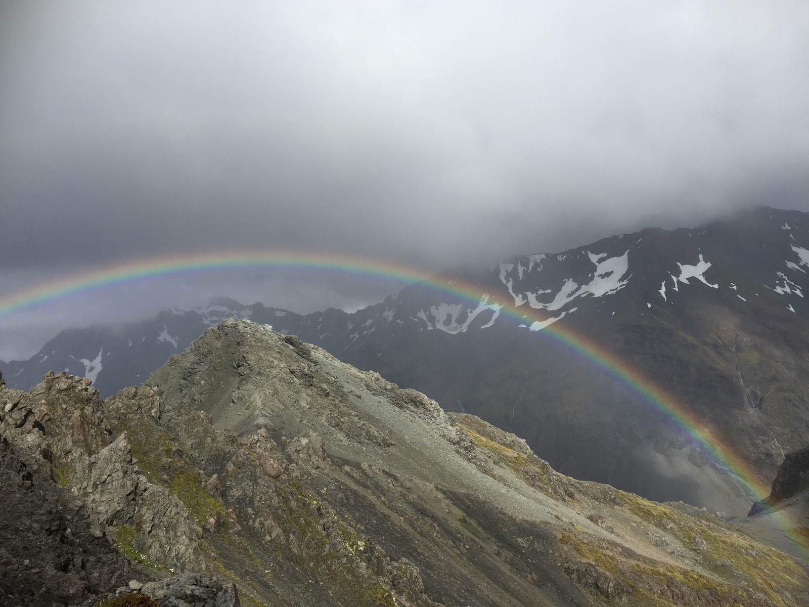
It’s all about to start. We wake at 5.30 in the morning to make the most of what should be an epic day. As we put our packs in the car I take a look outside at the weather, it’s not great but the sound of the cicadas in the hills begins to fuel my love for adventure and my passion in the outdoors. The car trip takes us through the staggering Arthurs Pass. The surrounding mountains are covered in low cloud, and you can feel the moisture in the air drifting from the misty rain. We’ve arrived!! By this stage our excitement and enthusiasm for what’s about to take place is on a whole new level. Were fresh and the anticipation of climbing to the top of this 1833 metre peak is growing even still. The first section of track climbs steadily and leads us to our first waterfall, Avalanche creek falls, then through mountain beach forest where more and more waterfalls revel themselves to us. This is my first chance to really get to know Nat. We have good chats and get to know each other in a way that only the outdoor environment can provide. Continuing up the tracks steep gradient we are forced to haul ourselves up tree roots which line the mark route. Few!!!! That’s’ the first section of track done. It’s now raining and my energy levels are diminishing so we stop for a gush of water and a quick bite to eat. Man oh man!!
 Never has an apple and banana taste that good. So with our rain jackets on and my energy levels restored we start climbing along a rocky spur where we meet up with the Scott’s track turn off. The finial ridge presents us with grand views of the Crow glacier, Surrounding mountain peaks and an unreal rainbow stretching the length of the valley. The wind is absolutely pumping and the air temperature is quickly dropping. Were there!! What an awesome feeling, we pause for a moment to soak it all up but the wind is so strong a moment is all we have. We seek shelter behind a rock; check out the summit for the last time before starting our descent.
 Never has an apple and banana taste that good. So with our rain jackets on and my energy levels restored we start climbing along a rocky spur where we meet up with the Scott’s track turn off. The finial ridge presents us with grand views of the Crow glacier, Surrounding mountain peaks and an unreal rainbow stretching the length of the valley. The wind is absolutely pumping and the air temperature is quickly dropping. Were there!! What an awesome feeling, we pause for a moment to soak it all up but the wind is so strong a moment is all we have. We seek shelter behind a rock; check out the summit for the last time before starting our descent.
On our way down a huge gust of wind inevitably forces us onto our hands and knees. We push onto Scott’s track, head down below the bush line and get out of the wind. From here the track is noticeably wetter and water is trickling and pooling in parts of the marked track. As we decline further we see fine view of the devils punchbowl water fall, and valley below. Were there! Four hours and ten minutes. What an effort we both look at each other and nail a high five.
Time to stop for lunch! We clamber down a few rocks and find a spot to sit where two small streams peacefully meet with each other. We eat our lunch to the sound of the soft water running through the rocks and reflect on the day’s expedition. So now what now? Carew falls seems like a good option so on our way we go.

SDL Tramp
Mount Brown Hut
Group Natalie Miedema
Instructor N/A
Duration Day trip
Date 27/1/16
Weather Overcast
Learnings
Date 27/1/16
Weather Overcast
Learnings
I’m up earlier and buzzing from the previous day. I’m not sure what todays going to bring but I’m still eager than ever. I wait for Nat to wake then tell here the plan. Mount brown hut it is! The day is cloudy but it appears the weather is on the improve. The drive takes us through Hokitika and onto Lake Kaniere. Lake Kaniere is stunning. The contrast between the deep blue lake and the moody grey weather surrounding the foot hills sets the scene. We start the walk through scrappy scrub. Conditions are damp, so our boots sinks in as we make our way through the, soggy water logged track. We make our way over to a pleasant stream and splash ourselves in the faces with the cold water. The splash of cold water makes us come alive! The feel, sound and even taste enhance our senses and refreshes our souls. Twenty minutes later and we find ourselves at the bottom of a steep spur.


The hut s not far from here and with it in sight we make our finial push. It’s taken us two hours or so to reach mount brown and with a smile on our faces we give each other a look of satisfaction. We stop for lunch and enjoy our pasta and a drink of water. At the top we take the opportunity to take some photos, selfie’s and some pictures of the cute bright Orange mount brown hut perched so perfectly on the ridge we stand on.
 We’ve enjoyed our time up here but it time to turn back round. We descend quickly through the tussock and back into the bush. The track is steep so we carefully choose our route and manoeuvre ourselves down the tree routed path. Along the way down Nat is stung by stinging nettle. I didn’t notice any stinging nettle on our way up so I think she’s slightly nuts until later on when I’m stung by some stinging nettle myself. We meet up with the stream wash the mud of our legs and finish the tramp in good time.
SDL Tramp
Kirwins Hut Victoria Forrest Park
Group Natalie Miedema
Instructor N/A
Duration Day trip
Date 28/1/16
Weather Overcast/Sun breaking through
Learnings
Date 28/1/16
Weather Overcast/Sun breaking through
Learnings
Day three, we’ve already crushed two amazing treks so I look for a hike that poses different challenges and that offers a bit of diversity. I search the weather on the internet and decide Reefton is the best option for the day ahead. There’s a walk up to Kirwins hut and if we make good time there is the possibility of doing an overnight circuit in a day. So the plan is made. We are to wake at five thirty in the morning and get on the road.
 The morning rolls round and we are up and at again. Were on time and have just driven into Reefton. The start of the track isn’t far from here but forty minutes in we realise that were in completely the wrong valley and that we are going to have to turn back round. This is more frustrating than anything and knowing we have a big day ahead of ourselves isn’t helping. Finial we arrive!! Were on the track and slowly the frustration of making the wrong turn is beginning to become forgotten. The first thing that strikes us is how beautiful the native bush is and how open the bush is around us. We make our way to what looks like a barren old mining road. The path to take isn’t clear so Nat pulls out her topo map and leads us on. The rocky path takes us down, until we find an exciting steeped slope short cut. This look like fun and with no hesitation at all we jump down it. The speed we pick up is amazing, I can feel adrenaline being pump round my body from almost being at the point where I can’t stop but an abrupt pile of harden dirt sloping up the opposite way brings me to an instant stop. Well!!! What a feeling, now I’m thriving and am amped for the day ahead.


We walk a further half hour following some markers before we realise we have missed the turn off. Again we refer to the topo maps and make a call to try and join up and follow a valley leading north. We start a hill climb full of branches and pine needles, it doesn’t slow us much but once we get to the top of the hill it appears going up the valley may not be the best or quickest option. A swift decision is made and we decided to back trail. As time goes on we hit our turn off and start making progress. The decision to turn around is proving to be a good one and we know we’re on the right track when we see the open cast Garvey Creek mine. As we make our way up the marked route we reach a sign for Capleston and Kirwins hut. To reach Kirwin hut from here is six hours over eleven kilometres. We initially followed a gravel path before reaching a short tunnel with a swing bridge at the end of it. We then continue to follow a pristine river with open beech forest on either side. This gently winds uphill and crosses a few more foot bridges. Nat and I are pushing the pace and although the track isn’t a difficult one I am sweeting like anything.

Pass the half way point to the hut the track just seems to keep going and going. It’s at this stage we both realise that by the time we arrive at the hut eating would be much too late. I’m already fading and need energy so we decide to stop for lunch. After lunch we continue on but I still don’t have any energy and I’m travelling at a very slow pace. This isn’t good because at this speed it would take us eight hours to get back to the car. I’m really struggling and I know that Nat really wants to get to Kirwins hill, a fifty minute side track overlooking the Victoria range. To get there would be awesome but deep down I know I need to rest up and prepare myself for the walk back. Nat and I have a yarn. I suggest to her that she carries onto Kirwin’s hill and that I push onto the hut where we can meet. We both agreed. I continued solo to the hut and started to notice a change in the bush. The bush became more dark and enclose, and the trees were all twisted and greater in height. I knew I was getting close and that I just had to get to the hut. Twenty minutes later and I was there. I was stuffed but man how cool was the hut, a double bay window overlooking the Inangahua valley and Paparoa Ranges. Now for a much needed rest. I hadn’t realised how thirst I was but I was stoked when I saw the hut had water. I filled my bottle and before I know it I’ve drunken a whole litre. I knew I needed energy so I pulled out a piece of corn and fish and had a bite to eat. While I rested and waited for Nat it became clear to me that I hadn’t managed my body and had let myself run out of energy and get dehydrated.

When Nat got to the hut I was well refreshed and in better shape. The decision to split up had proved to be a good one. Nat took a short break, took some photos from the hut and on we went. Nat had been worried about how long the rest of the trip would take me but when I started cranking the pace and explaining that I need to manage my food and water better she knew I was up for the challenge.
The next section of track leads to the Montomerie hut roughly three hours from here. Along the way the track passes old mining sites. As you zigzag down the track some of the mining remains that are left abandon are tools, two ore buckets, a Shacklock stove, two large wheels and not to mention the impressive Lord Brassey Battery. While coming down this section of track we startle a wild goat and we get to have a good look at it. From here the track gradual winds its way down through the forest until you meet up with Kirwins creek and then further onto Montgomerie River. We follow the peaceful Montgomerie River downstream to eventually we reach the Motgomerie hut. We take the time to have a break, Nat patches up here blisters and we check out the dingy hut. Bellow the hut is a sweet swimming hole. Unfortunately we don’t have the time to stop because it’s around six o clock and we still have about three hours of the trek remaining. The last section of the trip leads us through a rough four wheel drive track where there are massive pools of water surrounding the route.
 At first we try and avoid them until we inevitably take the plunge and power through. The four wheel drive track just keeps going and going and we’re both feeling the effect of our muscles fatiguing and aching. Finally three hours later we’re there. What a trip and an achievement!!
 At first we try and avoid them until we inevitably take the plunge and power through. The four wheel drive track just keeps going and going and we’re both feeling the effect of our muscles fatiguing and aching. Finally three hours later we’re there. What a trip and an achievement!!
The feeling of being at the car is amazing. Nats so happy she gets me hug the car and takes a photo. The trip back brings up good yarn about the day, challenges and how crazy we both are. But never has a trip been as satisfying and the sunset we can see in the distance is unreal. The days done and dusted what once was new is now old. So on with the new we go.
SDL Tramp
Mount Alexander
Group Natalie Miedema
Instructor N/A
Duration Day trip
Date 29/1/16
Weather Overcast
Learnings
Date 29/1/16
Weather Overcast
Learnings

It’s an abrupt start to the morning, its three thirty am. My muscles are still sore from the day before but I want to see how far I can push my body. Natalie going to go regardless and deep down I know there is no way she should be walking solo, so I make the call to go. The car ride takes us towards Otira and onto Lake Brunner road where we reach our start point at camp creek. Its sill dark so with our head torch’s lighting the way on we march. We’re not moving fast but today is all about pacing ourselves and making smart decisions. The track initially follows the side of Camp stream, through thick bush and out into the creek where we bolder hop and manoeuvre our way through. We continue following camp stream and there we meet our first river crossing. It’s dark and we don’t want to take any unnecessary risks so with our arms linked, across the stream we go. Following the mark track we hop over boulders, cross small tributaries and haul ourselves up muddy banks where we start climbing a spur. Once near the top of the spur we started making our way across a hill and back towards camp stream. By this stage the sun is starting to provide light, so were able to look out and see ourselves high above the creek. The splendours stream is fast moving and crashing through rock and boulders. The stream is a brilliant turquoise blue and in the distance we can see it crashing over a spectacular drop.
 The route flattens out, we make our second river crossing and after a while we reach the turn off to the Camp Creek hut. I have a discussion with Nat and we make a plan to have a break just before we get to the steep part of the spur. Leading up to the spur we walk a bogged track, pooled with water and mosey swamp land. Just after that section we take a break.

From here the track climbs steeply before reaching a series of knobs which provide welcomed stops for a slurp of water and a quick rests. As we climbed the bush begins to transform. We come out from enclosed bush and out into open tussock. The open tussock gradient steepened and now following a series of orange tipped poles we battle our way and make the grunt up to the top of the ridge. It’s an amazing feeling being at the top of the ridge and a real sense of achievement. We don’t get to see a view today because the clouds are blocking every direction, the air temperature is cool and the winds are blowing strong. Visibility isn’t great and if it gets any worse we’re going have to climb back down. It’s an awesome environment we find ourselves in but one that will need to be managed. So we take cover behind a large rock and change into warmer gear. We head east climbing up a ridge and over and around large jagged rocks. The power of the wind is incredible, it pushed the clouds up the mountain and spits them out the other side of the peak. The clouds never stood a chance and are being thrown at will. We’re both getting tired and our speed of travel has dropped. We’re not far from the top and we know once we’re there we get to stop for lunch. The higher we get the more we find ourselves climbing and surrounded in huge mounds and piles of rough, jagged rocks.


SDL Tramp
Mount Alexander
Group Ryan Colley
Instructor N/A
Duration 3 Day trip
Date 9/4/16 - 11/4/16
Weather Fine weather day 1, Overcast day 2 & 3
Learnings
Date 9/4/16 - 11/4/16
Weather Fine weather day 1, Overcast day 2 & 3
Learnings
No comments:
Post a Comment